


flyNav Flight Navigation app for iPhone and iPad
Developer: Walter Greger
First release : 11 Oct 2015
App size: 3.89 Mb
flyNav is a flight navigation app for VFR.
Overview Features:
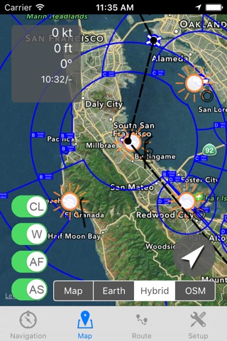
- Moving map flight navigation with vector based maps
- Airspaces for USA & Europe included
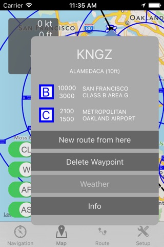
- About 20.000 airfields & airports worldwide
- Navaids VOR, DME, NDB for Europe
- Supported devices: Apple iPhone, Apple iPad and Apple Watch
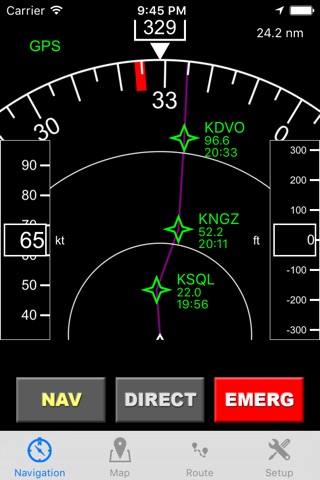
- Easy-to-read Navigation Display
- On-route weather & NOTAM information
Detailed Feature:
- Waypoints database with about 20.000 airfields & airports worldwide
- Airspaces for USA, Canada, Germany, France, Italy, Swiss, Austria, Belgium, Hungary, Finnland,...
- Moving map with vector based data (offline available!)
- Navigation display with course and bearing indicator incl. waypoint distance and ETA
- Altimeter with flight level support (using barometric sensor)
- Plan a route directly in map via touch & drag
- Automatic link of map orientation to airplane course
- 5 minutes indicator
- Manual route planner with ICAO & city search
- Load & save routes
- Automatic detection of take off time and touch down time
- Track your flights via GPX
- Emergency function: find nearest airfield and check if its reachable
- Import additional airspaces via openair format, e.g. traffic circuits
- On-route NOTAM
- On-route weather
- Flight-log in PDF-format (printable & exportable)
The handbook can be downloaded at http://www.flynav-app.com